
Over 25 Million People Under Severe Thunderstorm Watch
More than 25 million people across the Northeast are under alert as strong to severe thunderstorms sweep the region. A severe thunderstorm watch has been issued from Maryland to Maine until 8 p.m. ET, covering much of the I-95 corridor — including Baltimore, Philadelphia, New York City and Boston.
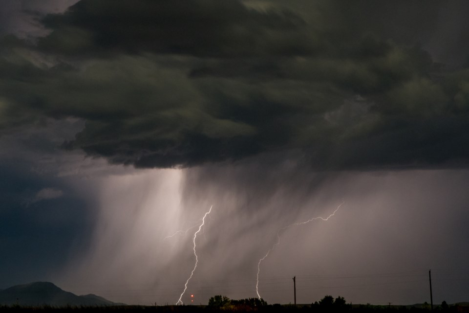
The main threats from any storms that develop are strong, potentially damaging wind gusts, isolated large hail and frequent lightning. A brief tornado or two cannot be ruled out, especially in parts of northern New England included in the watch.
What to Expect Tonight: Wind, Hail, Lightning and Local Flooding
Storms could be slow-moving in some spots, which raises the chance of torrential rain and localized flash flooding — a particular concern in urban neighborhoods and areas with poor drainage. The highest flash-flooding threat (Level 2 of 4) stretches from Philadelphia to Bridgeport, Connecticut, where multiple rounds of heavy rain from overlapping and training storms could produce localized to scattered flooding.
- Primary hazards: damaging winds, large hail, frequent lightning.
- Tornado risk: a slim chance of a brief tornado or two, mainly in northern New England.
- Flooding risk: localized flash flooding from slow or training storms, highest from Philadelphia to Bridgeport (Level 2 of 4).
Timing and Impact Into the Overnight
Damaging winds, large hail and lightning will be possible early Saturday evening and into the overnight hours across the watch area. The storms are expected to continue into the night, then give way to cooler, fall-like air sweeping in behind the front for the second half of the weekend.
That refreshing air won’t stick around forever — gradual warming is expected next week from west to east — but for now the focus is on storm safety and flooding concerns.
Where Residents Should Be Careful
Cities and towns along the Interstate 95 corridor should stay alert. And communities in northern New England should be mindful of the small tornado threat. Urban areas with known drainage problems are especially vulnerable to sudden, heavy downpours.
If you live in or plan to travel through affected places like Boston or Worcester, monitor local updates and any severe thunderstorm warning or tornado warning for your area.
For ongoing severe thunderstorm watch updates, radar-checked forecasts and the latest on possible tornado Massachusetts and tornado warnings, follow TNN. For continuous coverage, US news today and Canada news today.


